

Hva vil du oppleve?
Hva vil du oppleve?
Hva vil du oppleve?
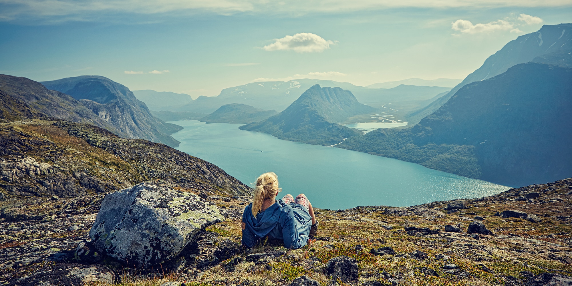
Velkommen til Valdres og Jotunheimen!
I Valdres og Jotunheimen – i hjertet av Norge, står du fritt til å velge din neste opplevelse. Vil du klatre luftige topper, eller bare kjenne på hvilepuls. Du kan velge høyt eller lavt, rolig eller fartsfylt, på ski, på to hjul eller på vandring – og nyte lokale matretter på koselige fjellstuer.
Vi tar hånd om reisen din, bagasjetransport og overnatting underveis. Helt enkelt.
Hvor går din neste tur?
Våre destinasjoner
Turer fra Oslo
Vi tilbyr flere turmuligheter fra Oslo til eventyr i Jotunheimen. Vi har egne busser som kjører deg helt frem fra hovedstaden, og du kan velge mellom dagsturer og fledagsturer.
Les mer›
Turer fra Beitostølen
Er du på Beitostølen og vil oppleve fantastiske naturopplevelser har vi mange alternativ. Velg mellom fart og spenning, eller rolige dagsturer. Her er det noe for alle.
Les mer›
Turer fra Bergen
Vil du komme fra vest, og besøke fantastiske Jotunheimen har vi egne busser som kjører deg helt frem. Velg mellom mange aktiviteter og turer hele året.
Les mer›
Dagsturer
Noen ganger passer det best med et kort eventyr. Vil du reise fra Oslo, eller Beitostølen, tar vi deg med til Jotunheimen for fantastiske dagsopplevelser i fjellet.
Hvilken tur velger du?
Velg deg en dagstur ›
Velg deg en dagstur ›
På sykkel i fjellet
Å ferdes i fjellet på sykkel er en helt unik opplevelse. Du tilbakelegger store avstander i et majestetisk landskap, omringet av fjell, vidder og dyr i et levende kulturlandskap.
Bli med oss på sykkeltur i Jotunheimen!
Velg deg en sykkeltur ›
Velg deg en sykkeltur ›
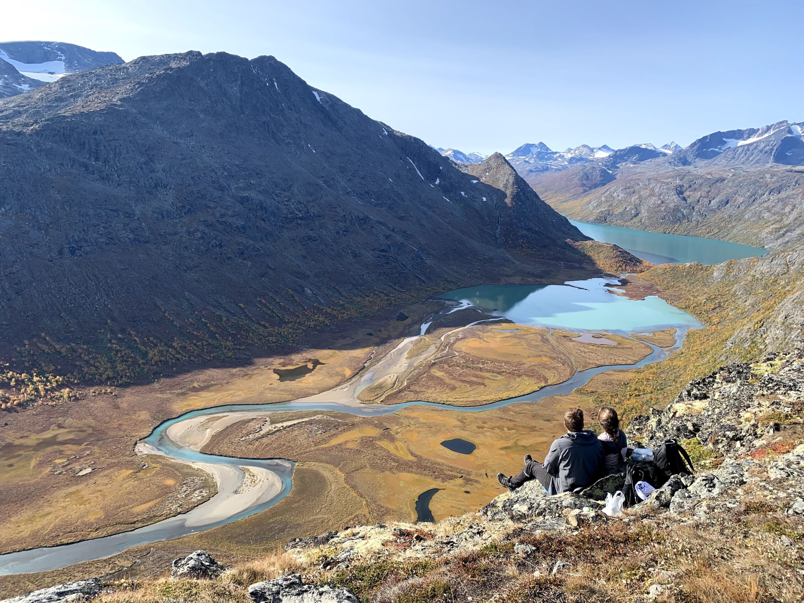
Sommereventyr
Jotunheimen om sommeren byr på magisk lys og storslåtte naturopplevelser. Kjenn på frihetsfølelse og mestring blant høye fjell, frodige daler, trollske steinurer og dyreliv. Nyt oppholdene på koselige fjellstuer med lokal historie og tradisjonsretter.
Bli med på tur i Jotunheimen!
Velg ditt sommereventyr ›
Velg ditt sommereventyr ›
Opplev Jotunheimen med oss!
Day to day
Practical information
Below you will find practical information about this trip.
Can not find what you are looking for? See our frequently asked questions page, or send us an email – we will help you!
Departures from Oslo
Monday-Wednesday
8.30 am – 1.05 pm
Thursdays
8.30 am – 1.05 pm
3.05 pm – 7.05 pm
5.00 pm – 9.05 pm
5.20 pm – 9.03 pm (Directly from Oslo Airport)
Friday
8.30 am - 1.05 pm
1.05 pm – 5.45 pm
5.20 pm – 9.03 pm (Directly from Oslo Airport)
Saturday
8.30 am - 1.05 pm
10.20 am – 1.35 pm
Sunday
10.20 am – 1.35 pm
12.20 pm – 4.50 pm
5.20 pm – 9.03 pm (Directly from Oslo Airport)
Luggage transport
We will send your luggage from cabin to cabin, so you only need to bring a daypack.
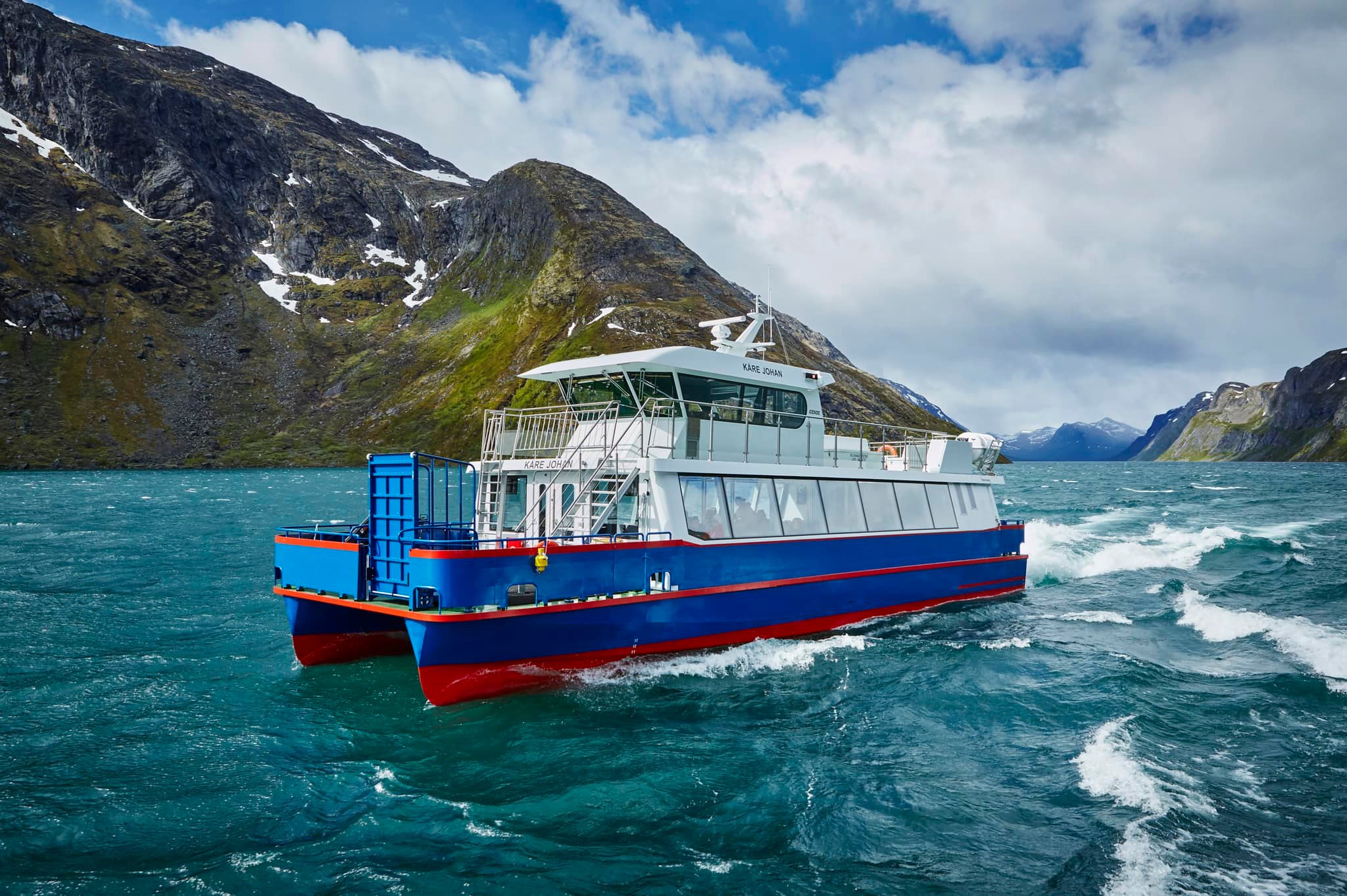
Departures from Gjendesheim
Monday-Friday
2.00 pm – 6.35 pm
Saturday
10.00 am – 2.45 pm
2.00 pm – 6.35 pm
Sunday
10.00 am – 2.45 pm
10.00 am -2.21 pm (Directly to Oslo Airport)
4.00 pm – 8.20 pm
5.35 pm – 10.00 pm
Meals
All restaurants offer food based on local ingredients. For breakfast, there will be a buffet. Here you also need to make yourself a packed lunch that you bring to lunch for the day. Use your beewax food wrap. It is possible to fill a thermos, check with the accommodation. Dinner will be served in the afternoon/evening.
Accomodation
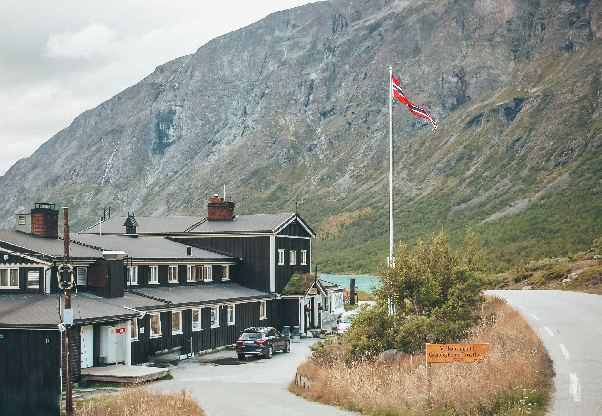
Gjendesheim Turisthytte DNT:
Gjendesheim Turisthytte has a history dating back to 1878. The hut is run by DNT and is located in the heart of the Norwegian mountains, with Besseggen Ridge as a neighbor.
Gjendebu Turisthytte DNT:
At 990 masl at the west end of Gjende Lake, you will find Gjendebu. The DNT cabin offers a traditional and historic atmosphere, with good local food – and is the oldest cabin of DNT, built in 1871.
Memurubu Turisthytte:
Memurubu is a tourist hut at the end or start of the famous Besseggen hiking trail. Memurubu is originally an old mountain pasture dating back to 1872, but has had tourists for just as long. Cows are still grazing around the tourist hut, which lies at the mouth of the river Muru in the valley Memurudalen.
Trails and weather
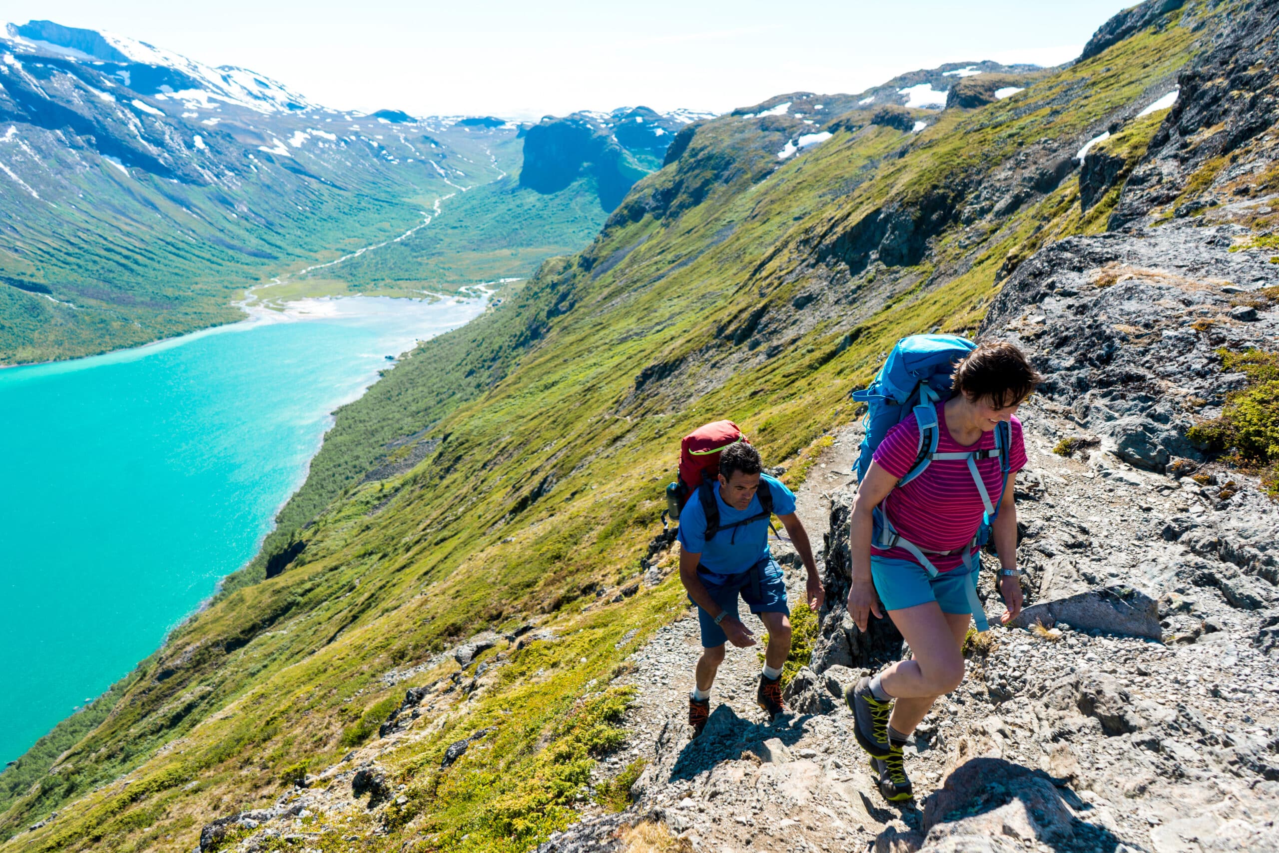
The conditions in the autumn are wonderful, but it can also give some challenges. You need to be prepared to walk in the snow in case of snowfall. We have also described alternative routes for the steepest parts if the exposure or conditions makes it uncountable. In September, normal temperature is between 0-10 degrees.
All the paths are well-marked. The terrain varies from flat and easy to rocky and hilly. All the hikes as a short steep, exposed crux where you will have to use both legs and arms. Thou these sections can be avoided by walking an alternative route around.
Equipment list
We will send you equipment-list when ordering.
Opplev Jotunheimen med oss!

Reis miljøvennlig til fjells
Alle våre turer er inkludert transport til og fra fjellet, og bagasjetransport underveis. Her reiser du komfortabelt med erfarne sjåfører, og moderne, miljøvennlige busser.
Når du reiser med våre busser, og bruker de lokale overnattingsbedriftene støtter du opp under et bærerkraftig reiseliv i regionen vår.

“Historisk rute Jotunheimen, er en tur vi ikke vil glemme. Naturen var et paradis å vandre i. Overnattingsstedene, den lokale maten, sømløs bagasjetransport og reise med hyggelige sjåfører gjorde turen helt komplett for vår del. Takk for en unik opplevelse!”
– John Evensen